Overview of the Trinity River’s Path and Basin
The Trinity River stretches about 710 miles, starting in northern Texas and flowing through major cities before hitting the Gulf Coast. Its vast watershed affects many areas, connecting communities in a shared effort to protect Texas’s water resources.
This journey highlights the basin’s vastness, merging farmland, reservoirs, and urban centers into a single waterway. Water quality and storage are monitored across the region, showing the network’s critical role in Texas’s water management.
Geographical Scope
The river begins in northern counties and flows through areas near Dallas-Fort Worth, extending southeast. Its importance grows with each mile, traversing diverse landscapes and supporting numerous stakeholders.
Key Tributaries
Several tributaries, including Elm Fork, West Fork, and East Fork, feed the main river. Reservoirs like Lake Livingston, Cedar Creek, and Richland-Chambers are vital, regulating the flow and meeting local needs.
Tributary | Contribution | Reservoir Connection |
Elm Fork | Supports northern flow and urban communities | Linked with city reservoirs |
West Fork | Serves major metropolitan water demands | Source for municipal storage |
East Fork | Routes additional runoff into main river | Flows toward Lake Livingston |
Why the Trinity River Water Level Matters
The Trinity River plays a critical role in Texas’s daily life. It supports irrigation for farmland and meets the water needs of cities. The steady flow is essential for drinking water supplies. Water managers closely monitor levels to mitigate flood risks in vulnerable areas.
Changes in reservoir storage in the Trinity River Basin reflect the impact of rainfall and drought. High levels ensure cities have enough drinking water. Low levels prompt conservation efforts. Adjusting usage is key to protecting essential services and keeping communities informed.
Effective water management strategies benefit fish, wildlife, and local habitats. Monitoring reservoir storage provides insights into usage patterns. This information guides decisions on urban growth and farmland. A balanced approach ensures drinking water, agricultural success, and nature’s balance.
Environmental Factors Affecting Flow
Climate changes and geological shifts influence river flow. Heavy rains increase water levels, while droughts slow it down. The Trinity River Authority’s data on river flow is invaluable, tracking changes over time.
Local groups and agencies compare daily flow data to spot trends. This helps communities prepare for water level changes. It’s a proactive measure to avoid critical situations.
Rainfall Patterns
Regular rain can quickly raise water levels. Some storms cause rapid increases, posing flood risks. Daily and weekly reports keep local groups informed, aiding in water resource management.
Groundwater Influence
Underground aquifers feed the river during dry times. This hidden source helps maintain a steady flow. Data from local monitors reveal how aquifers support the river system. This information aids in regional planning and promotes water conservation.
Historical Trends and Water Data
For decades, local agencies and the U.S. Army Corps of Engineers have collected vital data on the Trinity River. These records show how dramatically flows change with weather patterns. Given our reliance on consistent resources, managing water supply remains a critical task.
Historical charts illustrate the Trinity River’s reservoir capacities, underscoring the importance of long-term planning. The fluctuating levels guide conservation efforts and shape decisions aimed at protecting the wider area.
Notable Flood Events
Heavy overflows have tested levees, leading to evacuations at times. The National Weather Service documented significant river surges, exposing weaknesses in our defenses. This has prompted demands for enhanced infrastructure.
Drought Periods
Severe dry spells, caused by low rainfall, have necessitated water rationing and community education. Local leaders emphasize the need to use the river’s reserves wisely to avoid shortages. Ensuring steady access to water is essential for both agriculture and residential use.
Current Monitoring and Reporting Efforts
Teams from the Trinity River Authority of Texas, USGS, and NOAA collect real-time data on water flow and precipitation. They focus on key measurements that indicate changes in the river’s behavior. In times of rising Trinity River flood levels, these updates reach local agencies. They help safeguard lives and property.
Their collaborative process involves close tracking of factors that influence the river’s activity. Observers keep watch on:
- Precipitation totals
- Reservoir capacity
- Discharge rates
Accurate data shapes decisions about dam releases and drought responses. Shared alerts encourage schools, businesses, and families to plan for sudden shifts in Trinity River flood levels. Coordination among these organizations keeps critical information flowing. It fosters community trust and empowers residents to prepare for weather extremes.
“Consistent analysis of water conditions is vital for public safety and long-term planning,” states a leading hydrology expert.
Reliable reports strengthen efforts to protect infrastructure, habitats, and livelihoods throughout the river basin. Discussions with state and regional partners align conservation goals. They bolster future sustainability.
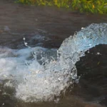
How trinity river water level Impacts Recreation and Safety
Visitors are drawn to the Trinity River for its paddling and sightseeing opportunities. The river’s depth can change, affecting its banks, currents, and challenges. Given its importance in Texas water resources, both locals and tourists monitor the water levels before venturing out.
Kayaking and Canoeing Tips
Beginners find calm sections perfect for their first forays. Yet, higher flows require more expertise. Enthused paddlers often adhere to official flow rates and heed posted warnings to sidestep unexpected dangers.
- Check real-time recordings from the Trinity River Authority
- Select launch sites with calm eddies when learning
- Bring a buddy to spot any hazards
Flow Range (cfs) | Recommended Activity | Skill Level |
Under 1,000 | Gentle kayaking or canoeing | Beginner |
1,000 – 2,500 | Moderate rapids | Intermediate |
Over 2,500 | Challenging whitewater | Advanced |
Safety Gear Recommendations
Depth changes can cause sudden water surges. Helmets shield against unexpected impacts, while life vests keep paddlers afloat during steep descents. Given the Trinity River’s role in Texas water resources, proper gear is essential for safety along its path.
Water Usage for Agriculture and Municipal Supply
Rural communities depend on consistent water access for irrigation and livestock care. Urban areas need reliable water for drinking, sanitation, and industrial use. It’s essential to balance these needs, as demand increases during peak seasons or urban growth. Monitoring reservoir storage in the Trinity River Basin aids in irrigation planning for farmers and resource management by local governments.
Municipal services rely on extensive systems that require daily tank level monitoring. A flexible strategy helps cities handle increased water treatment needs and manage their infrastructure. The rise in residential and commercial areas puts more pressure on shared water sources. Having up-to-date data on reservoir storage in the Trinity River Basin promotes collaboration between farmers and urban planners. This cooperation helps preserve water supplies and prevent shortages.
Usage | Primary Need | Key Consideration |
Agriculture | Irrigate crops, support livestock | Seasonal water demands |
Municipal Supply | Drinking water, sanitation | Infrastructure capacity |
The Role of Local Agencies and River Authorities
Local oversight groups, such as the Trinity River Authority, monitor critical measurements that guide water management strategies. They collaborate with federal agencies like NOAA and USGS to analyze patterns, share reservoir information, and study river flow data. This collaboration enables efficient planning and helps predict high-water seasons. It also sets priorities for long-term resource protection.
Collaboration with State Departments
Working closely with the Texas Commission on Environmental Quality streamlines watershed oversight. Teams exchange reports on water quality, reservoir conditions, and weather forecasts. This synergy leads to practical conservation guidelines and flood-mitigation strategies tailored to community needs.
Public Outreach and Education
Officials conduct workshops and engage with schools to promote local waterway stewardship. They teach how to read daily flow metrics and understand rising trends. Through in-person meetings and online tools, residents receive timely updates. This empowers them to make informed decisions during both dry and wet periods.
Agency | Primary Task | Shared Data |
Trinity River Authority | Watershed Management | Reservoir metrics, river flow data |
Texas Commission on Environmental Quality | Regulatory Oversight | Water quality findings |
NOAA & USGS | Forecasting & Analysis | Weather updates, flow trends |
Environmental Considerations and Wildlife Impact
Preserving the river’s delicate balance requires careful planning. Adjustments in flow protect fish species, wetlands, and habitats that thrive near the water. Agencies focus on water supply management while protecting biodiversity. They track conservation storage to plan releases that support breeding patterns.
Catfish and bass need stable currents for successful spawning. Migratory birds rely on marshlands that form when flow levels are maintained. These conditions are critical for their survival.
Check the updated river data for insights into current reservoir trends. Local experts use these statistics to decide when to adjust flows. This approach protects ecosystems from extreme changes that could disrupt feeding cycles or nesting sites.
Habitat Preservation
Natural shorelines with healthy vegetation reduce erosion and provide safe zones for smaller creatures. Plants along the banks act as filters, removing sediments before they enter the water. Thoughtful water supply management preserves these plant buffers.
Supporting Native Species
- Stable flows during spawning seasons
- Protection of feeding areas and wetlands
- Guidelines discouraging overfishing
Key Wildlife | Management Strategy |
Catfish | Regulated discharge to maintain spawning zones |
Bass | Balanced flow levels for nursery habitats |
Migratory Birds | Protected marshland for nesting and feeding |
Amphibians | Seasonal releases that retain shallow wetlands |
Community Preparedness During Extreme Weather
Tropical storms can overwhelm the Trinity River basin with relentless rain. Many towns rely on advanced forecasts to plan for rising water conditions.
When Trinity River flood levels peak, local officials reinforce vulnerable areas with sandbags and other barriers. This practical defense helps reduce structural damage and gives residents time to secure personal belongings.
Evacuation plans depend on accurate historical data that shines a light on past flood events. Early coordination lets communities shuttle families to safe zones before situations escalate.
Schools and civic centers serve as makeshift shelters, providing urgent support for those in low-lying neighborhoods. Real-time alerts guide individuals in monitoring conditions, while coordinated rescue teams act when roads become impassable.
Learning from storms helps leaders refine emergency guidelines. Tracking Trinity River flood levels over time aids future planning and fosters a culture of readiness.
Online Platforms for Real-Time Level Updates
Modern tools provide instant insights into the Trinity River’s changing conditions. Residents and travelers use online dashboards to stay informed and plan their activities. These updates are critical for managing Texas water resources, where sudden changes can affect recreation and local communities.
Website Tools and Apps
Dedicated platforms share live data from trusted sources. Some sites note the accuracy of their information, yet they are valued for their quick updates. These platforms often include user-friendly charts and historical comparisons. People rely on them for information on water flow and reservoir levels, including:
- Interactive maps showing hourly changes
- Mobile alerts for critical fluctuations
- Simple interfaces for quick checks
Radio and Alert Systems
Emergency networks broadcast advisories when waters surge. Local stations deliver swift bulletins to boaters and campers. Agencies with ties to NOAA or the USGS release timely updates for communities tracking Texas water resources. Early warnings encourage safe decisions and help everyone take action on short notice.
Platform | Main Feature | Benefit |
Official River Website | Up-to-date gauge readings | Quick monitoring of rising or falling levels |
Mobile Alert Apps | Push notifications | Real-time emergency updates |
Local Radio Stations | Live on-air alerts | Timely announcements for listeners on the go |
Moving Forward with Watershed Awareness
Everyone who relies on the Trinity River has a role in safeguarding its water. Through careful planning and community efforts, we ensure healthy water flows even when demand increases and rainfall patterns change. Leaders implement policies that balance land use and resource protection.
Strong partnerships between government, industry, and citizens are essential for sustainable reservoir storage in the Trinity River Basin. Local agencies work with experts to monitor weather, protect water quality, and safeguard wildlife habitats. Research networks exchange knowledge, helping to develop effective solutions for future generations.
Public outreach is key to involving more people in the conversation. Volunteer groups organize river cleanups and educational events, fostering a sense of responsibility for the water. This connection inspires long-term stewardship. Together, we can keep the Trinity River flowing, meeting both our daily needs and preserving natural ecosystems.
FAQ
Why do Trinity River water levels fluctuate?
Water levels change due to rainfall, evaporation, and reservoir operations. Groundwater recharge also plays a role. These factors impact the river’s flow.
What is the Trinity River’s approximate length, and why is it important?
The river is about 710 miles long in Texas. Its vast length means many areas face flow variations and flood risks. This highlights the importance of managing Texas water resources.
How do Trinity River flood levels affect local communities?
Floods can damage infrastructure, crops, and homes. Monitoring flood levels helps prepare for evacuations and protection measures. This is vital for residents and emergency services.
Why is reservoir storage in the Trinity River Basin so critical?
Reservoirs store water for various uses. Tracking their levels is key during droughts. It affects water availability and usage strategies.
Which agencies monitor the Trinity River’s current conditions?
The Trinity River Authority, USGS, and NOAA track the river. They provide stream-gauge readings and flow rates. Their data is for informational purposes only.
What role do local authorities play in managing river levels and flood control?
Local agencies work with state departments on reservoir releases and conservation. They also implement flood policies. Public programs keep communities informed about water management and emergency plans.
How does the Trinity River’s water level impact recreational users?
Stable flow rates are essential for activities like kayaking and fishing. Changes in level can affect currents and navigation. Checking official sources helps users stay updated.
Why do historical trends and weather data matter for future planning?
Analyzing past events helps predict river responses to weather. This information supports better planning for city planners, farmers, and conservationists. It ensures the river’s reliability.
Does groundwater play a significant role in maintaining flow during dry seasons?
Yes, aquifers recharge the river during dry times. This helps maintain flow. But, overuse can deplete this resource.
What steps can communities take to ensure sustainable water usage?
Communities can promote water conservation and support watershed initiatives. Upgrading infrastructure is also important. Balancing demands with ecosystem needs ensures the river’s flow for the future.